National Hurricane Season 2016

A tropical wave that's spinning in the Caribbean is forecast to strengthen and could hit both Florida and the sodden Gulf Coast over the next few days, possibly as a hurricane, meteorologists say.

The system has a 60% chance of developing into a tropical depression or named storm within the next two days, according to the National Hurricane Center. If it gets a name, it would be Hermine (Her-MEEN), the 8th named storm of the 2016 Atlantic hurricane season. 


After a potential hit as a hurricane in Florida, the system could then get pushed into the Gulf of Mexico, with the potential for a second landfall somewhere along the Gulf Coast next week, possibly as a strong hurricane, weather.com meteorologist Jon Erdman reported.

"A track somewhere through Florida or the Florida Straits and into the Gulf appears to be the most likely outcome," according to the Weather Underground. 

That's dreadful news for portions of Louisiana still reeling from catastrophic flooding last week that killed 13 people and left thousands of homes underwater.

With the moist, saturated soil in Louisiana, the area "could quickly experience flooding again," according to National Weather Service meteorologist Timothy Destri of the New Orleans office. The worst case would be if the storm hits to the west of the region, which would bring the heaviest rain into Louisiana, he said.

As of late Wednesday afternoon, several rivers in Louisiana remain in flood stage, the Lower Mississippi Valley River Forecast Center said. 

The system, which was located about 1,000 miles southeast of Miami late Wednesday afternoon, is forecast to take a general west to west-northwest path near the Dominican Republic and Haiti on Thursday. 

If it hits Florida as a hurricane, it would be the first hurricane to strike the Florida Peninsula since Wilma in October 2005," according to Accu Weather hurricane expert Dan Kottlowski.

Regardless of whether or not the system becomes a tropical storm or hurricane, gusty winds, heavy rains, and possible flash floods and mudslides should occur over the islands of the northeastern Caribean Sea and the Bahamas, the hurricane center warned.

"All people living and having interests in and around the Bahamas, Cuba and Florida should closely monitor the movement of this evolving tropical system through this weekend," Kottlowski added.

Thank you for reading & watching. Don't forget to subscribe, like, share and comment to get more news & videos. 
- - - - - - - - - - - - - - - - - - - - - - - - - - - - - - - - - - - - - - - - - - - - - - -
Subscribe us on Youtube https://www.youtube.com/dailynews99
Like us on Facebook https://www.facebook.com/dailynews99
Follow us on Google Plus https://plus.google.com/+dailynews99
Watch all videos at https://www.youtube.com/view_all_playlists
Visit Website: www.worldnewsheadlinesdaily.blogspot.com
- - - - - - - - - - - - - - - - - - - - - - - - - - - - - - - - - - - - - - - - - - - - - - -
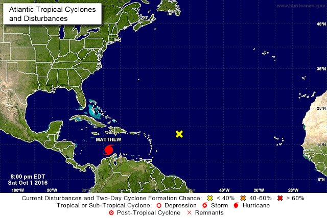
National Hurricane Season 2016


National Hurricane Season 2016

A tropical wave that's spinning in the Caribbean is forecast to strengthen and could hit both Florida and the sodden Gulf Coast over the next few days, possibly as a hurricane, meteorologists say.

The system has a 60% chance of developing into a tropical depression or named storm within the next two days, according to the National Hurricane Center. If it gets a name, it would be Hermine (Her-MEEN), the 8th named storm of the 2016 Atlantic hurricane season. 


After a potential hit as a hurricane in Florida, the system could then get pushed into the Gulf of Mexico, with the potential for a second landfall somewhere along the Gulf Coast next week, possibly as a strong hurricane, weather.com meteorologist Jon Erdman reported.

"A track somewhere through Florida or the Florida Straits and into the Gulf appears to be the most likely outcome," according to the Weather Underground. 

That's dreadful news for portions of Louisiana still reeling from catastrophic flooding last week that killed 13 people and left thousands of homes underwater.

With the moist, saturated soil in Louisiana, the area "could quickly experience flooding again," according to National Weather Service meteorologist Timothy Destri of the New Orleans office. The worst case would be if the storm hits to the west of the region, which would bring the heaviest rain into Louisiana, he said.

As of late Wednesday afternoon, several rivers in Louisiana remain in flood stage, the Lower Mississippi Valley River Forecast Center said. 

The system, which was located about 1,000 miles southeast of Miami late Wednesday afternoon, is forecast to take a general west to west-northwest path near the Dominican Republic and Haiti on Thursday. 

If it hits Florida as a hurricane, it would be the first hurricane to strike the Florida Peninsula since Wilma in October 2005," according to Accu Weather hurricane expert Dan Kottlowski.

Regardless of whether or not the system becomes a tropical storm or hurricane, gusty winds, heavy rains, and possible flash floods and mudslides should occur over the islands of the northeastern Caribean Sea and the Bahamas, the hurricane center warned.

"All people living and having interests in and around the Bahamas, Cuba and Florida should closely monitor the movement of this evolving tropical system through this weekend," Kottlowski added.

Thank you for reading & watching. Don't forget to subscribe, like, share and comment to get more news & videos. 
- - - - - - - - - - - - - - - - - - - - - - - - - - - - - - - - - - - - - - - - - - - - - - -
Subscribe us on Youtube https://www.youtube.com/dailynews99
Like us on Facebook https://www.facebook.com/dailynews99
Follow us on Google Plus https://plus.google.com/+dailynews99
Watch all videos at https://www.youtube.com/view_all_playlists
Visit Website: www.worldnewsheadlinesdaily.blogspot.com
- - - - - - - - - - - - - - - - - - - - - - - - - - - - - - - - - - - - - - - - - - - - - - -